
Part VII
Hiking in the Rocky Mountains
The first on the list was Mt. Teepee. The second highest mountain here in in the Kootenay Rockies, a moderate hike but with an elevation gain of almost 5000 feet over 6 km a cruel one.

Once Mt. Stevens is reached though the views are sure rewarding. Andrea and Trudy celebrating that we got that far and Lexie is is heading for the snow to cool off her paws.

And while I was busy photographing all the alpine micro flora and fauna, Trudy and Andrea spotted a pair of Mountain Goats....I, of course, saw only the fleeing bums...;-)

Purple Saxifrage in the foreground with Teepee "looming" in the back
From the summit of Mt. Stevens it seems to be just a short hike over Mt. Stevens Pass and a quick scramble up Mt. Teepee.

"Alpine" ladybugs at an elevation of 8700 ft.
Well, it only seems quick, in reality it is a loooong and exhausting scramble

But we made it: The Summit Girls!

The views are spectacular, the Rocky Mountain range up to the horizon in the East,

Note: If you click on the images they open up larger in a separate window for a better view.
Highly recommended for the panorama images!

Premier Lake and the Columbia Valley to the North

and Lazy Lake, Wasa Lake and the Kootenay Valley to the South-West.

The next hike led Mika and me to Bear Lake, a nice and easy hike with some exceptional wildflower views.

Once we got the steep forest trail behind us a nice little valley opened up with bear Lake shimmering in it's middle.

After a short rest on the shore, we decided to hike up to the Bear Lake/Rualt Lake pass to have our lunch with a view. Here a look back to Bear Lake from about half way up.

On the ridge...

View with Rualt Lake in the foreground and Summer Lake in the distance
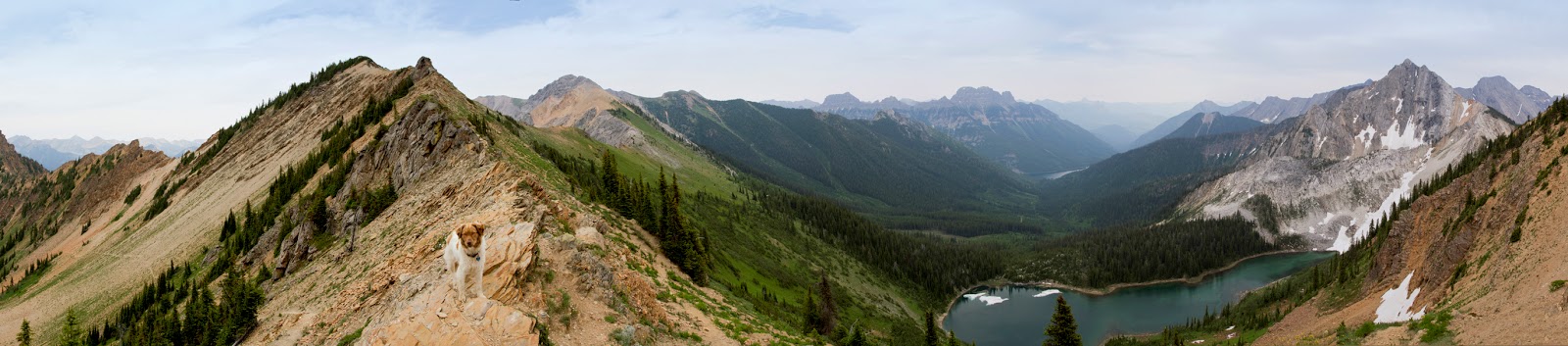
My partners in crime, with one missing....

ah, there he is..;-)

Happy Hiker Selfie

Beautiful wildflowers all over the mountain side...

...unidentified yellow beauty...

...Milberts Tortoise Shell butterfly...
...and my flower girl.

The last and most epic hike was a hike that was on our bucket list since quite awhile. We were ready for it last year, but the spring flood had taken out a good part of the road and the trail head was not accessible. This year though the hiking gods were with us: Fisher Peak

As with almost all hikes here in the Rockies one has to first overcome a steep forested trail. On the Fisher Peak trail this first part leads you to an nice level area with a small creek-fed pond. As Mika put it: "A scene that could be right out of a fairy tale".

The following scramble up to the saddle was my least favorite part of this hike, but the views make up for it.

The climb from the col to the summit was quite an adventure, more than once I asked myself, how in the world would I ever get back down...

But then, seemingly on top of the world, at an elevation of 9336 ft, all worries evaporate and the majestic views are taking over

A 360 panorama taken from the small platform at the summit.
Please click on the image for a better view

Anise Swallowtail
It surprises me over and over how butterflies and other insects can make a living at these heights.
After one last glance down at this lichen covered rock formation we started our descent. Luckily going down was way easier than anticipated and finally back at the car we agreed that this is a more technically challenging hike than Mt. Teepee but a way less strenuous one.
We had planned to hike to Tanglefoot Lake this last week, but the storm that hit shortly before that had big trees thrown across the road like matches between the Fisher Peak trail head and the Mause Creek parking lot. We will have to postpone that one.
Sources for all these hikes are from Janice Strongs' book:
Mountain Footsteps, Hikes in the East Kootenay of Southwestern British Columbia


